pierr
Well-known member
dunque, la scimmietta mi dice che quest'estate vorrebbe azzardare, se ci fossero determinate condizioni, una traversata d'alta montagna ma non riesco a trovare informazioni approfondite sulla parte più critica del mio potenziale itinerario.
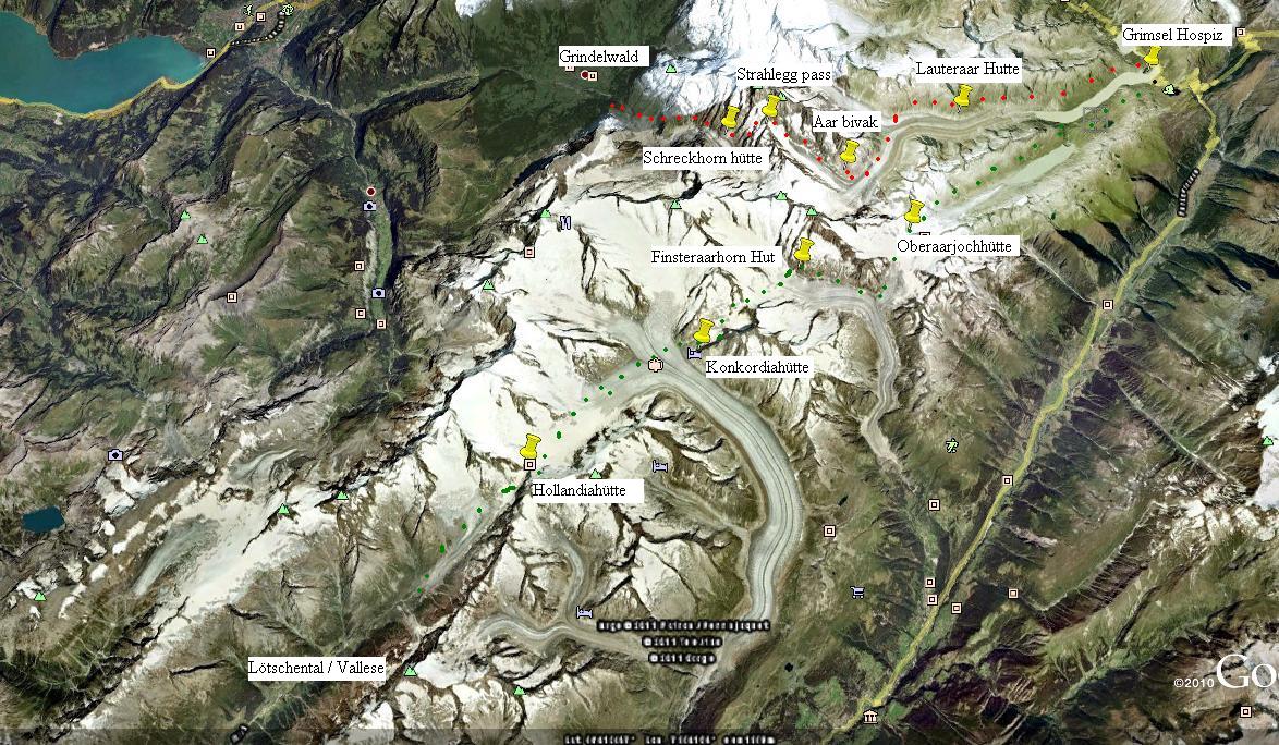
Questa parte su cui sto cercando informazioni è il passo Strahlegg, la via più facile di collegamento tra il passo Grimsel e Grindelwald, rispettivamente punto di partenza e di arrivo nella mia idea di itinerario.
Ho trovato questo:
FROM THE EAST (che farei in salita) PD From the Aar bivouac descend to the Strahlegg glacier and climb up
to the top of the central moraine. Follow this for about 500m before
descending onto the clean glacier on the L. Keep more or less in the
centre of the glacier, and where it begins to steepen turn NW to
reach the bergschrund at the foot of the snow couloir leading to the
col. Cross it where practicable (often on the R) then climb the
couloir, crossing some loose rock / scree on the R near the top. 3hr
FROM THE WEST (che farei in discesa) F From the Schreckhorn hut follow the track to the site of the old
Strahlegg hut across moraine and snow patches (1hr). A good track
leads steeply up into the coombe to the E and is followed to an easy
angled rock ridge. Climb it to a snowy shoulder at about 3200m.
Head up now to the foot of a rock ridge descending SW from
Pt 3428m and, keeping to the R (S) of this ridge, reach the col by
less steep slopes. 2 hr, 3 hr in all.
che grado di difficoltà sono "PD" e "F"?
Le coordinate dovrebbero essere 46.577438° e 8.118486°
 visto che tutte le relazioni alpinistiche delle nostre alpi sono classificate col sistema francese!